Hiking & Exploring Kentucky's Red River Gorge
Entry posted by Steve Ancik in Trips ·
1,319 views
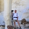
Usually when I travel, I am pulled to the west – New Mexico, Arizona, Utah, and surrounding areas. For my latest trip, however, I headed in the opposite direction and visited a place that I had first heard about several years ago: Red River Gorge Geologic Area in northeastern Kentucky. My companion for this trip was Joel, with whom I’ve taken several other trips, both mountain biking and hiking. We left Oklahoma on October 2nd, 2022 and spent four days hiking in the area.

The Red River Gorge Geologic Area (RRGGA) is a 29,000 acre (45 sq. mile) forested area within the Daniel Boone National Forest. The park has numerous beautiful sandstone cliffs and rock shelters, multiple natural arches and bridges, and huge trees. Within the area are over 60 miles of trails. There are over 100 natural bridges and arches. Natural arches and bridges can be formed when softer rock wears away from harder rock, and via the forces of water flowing under and through the rock. The RRGGA has both forms of natural arches. The natural forces mentioned above are usually a combination of wind erosion, water movement, freeze-thaw action, and gravity.
Compared with the much better known Arches National Park (120 sq. miles and over 2,000 arches) you need to work a bit harder to see the arches of RRGGA, but they are definitely worth the effort. Adjoining the park is the Clifty Wilderness, which we did not visit, and Kentucky’s Natural Bridge State Park, which we did visit. We were hoping to see some nice fall color along with the hikes, and we were partially rewarded – the ridge tops had beautiful bright reds, oranges, and yellows, while the canyons’ trees were mostly unchanged from their summer greens. A week or two later would have shown more color in the lower parts, but the ridge tops would probably have been left with fewer vivid colors.
A Red River Gorge Hiking Trip
Our drive from Oklahoma took about a day and a half, so we arrived at the Gorge around mid-day. We drove into the park from the west, passing through the Nada Tunnel, built in 1910-1912 for hauling lumber. It’s 900 feet long, and just 12 feet high and wide – seemed way too small for a train, but I guess they were smaller back then. Our first stop was the Gladie Cultural-Environmental Learning Center to see if there were any restrictions or other concerns. After looking at the exhibits and buying a couple of items at the nice gift shop there, we drove clockwise around the park to Koomer Ridge Campground, where we set up our tents and gear. As national forest campgrounds go, it’s pretty nice – widely-spaced sites, picnic tables, nice flat tent sites, pit toilets and one bathhouse with showers, and lots of towering trees.

Once we set up camp, we proceeded to get in our first couple of hikes – Silvermine Arch and Hidden Arch, both trailheads leaving from the campground. Neither of these were long or strenuous hikes – 1.6 miles and 1.4 miles respectively. We happened to camp at Site #37, so we were just one site away from a short spur trail that led to the Silvermine Arch Trail. This trail starts off pretty easy, winding through the oak, maple, and pine forest until you arrive at the edge of a cliff. There is a long staircase (79 steps) down into the ravine. Not far beyond is Silvermine Arch, surrounded by ferns and rhododendrons. The arch itself is 9 feet high and spans 58 feet and is sort of back against the cliff behind it, making it difficult to photograph, but still a worthy destination.
Hidden Arch Trail starts near the camp host’s campsite and drops through the forest to the small (only about 4 ½ feet high and 6 feet wide) but impressive arch. This was a nice easy late afternoon hike to finish off our first day. The trail also connects to a couple of other trails if you want to extend the hike.

The next morning, we started what would be our longest hike of the trip. After a few-mile drive on Tunnel Ridge Road (graded gravel) and after crossing the ridge under which the Nada Tunnel runs, we arrived at the Auxier Ridge Trailhead. At the time, I did not know how far I would be able to hike, as I was scheduled for knee replacement surgery later in October. I had been given a shot of cortisone in my knee in July, which helped with the pain, but was unsure how long it would last. So, based on that, we headed toward Courthouse Rock along the Auxier Ridge, figuring I could rest at Courthouse Rock (about two miles from where we parked) and then turn back if needed. Auxier Ridge, as the name implies, is a long north-south ridge with fantastic views of the surrounding canyons both to the east and the west. Up on the top of the ridge the maples, sassafras, and other trees had turned to bright reds, yellows, and oranges, while the valleys below were still various shades of green. Also visible across the canyon to the west was Double Arch.

Once we got to Courthouse Rock, which we had been seeing rising out of the canyon below for some distance, we rested and I decided that my knee was good to go, so on we went! Turning back south and steeply down, we hiked into the canyon to the west of Auxier Ridge. A connecting trail allowed us to climb back up to the next ridge where Double Arch is located. This trail led around the end of the ridge and finally up under Double Arch. The arch is quite impressive, with a span of 30 feet and a height of 12 feet, plus a bonus arch directly above the main arch. The upper arch is just a couple feet high and 20 feet wide, and difficult to see when you’re at the main arch, but both arches are clearly visible from across the canyon when you are on Auxier Ridge. Once we had a lunch break and took our fill of photos, we moved on, The trail from here back toward the trailhead is mostly down in the canyon, filled with 100 to 150-foot tall sycamores, maples, oaks, pines, and hickories, as well as the smaller eastern hemlocks and bigleaf magnolias (the leaves on those are truly HUGE – often almost a foot and a half long!).
Eventually, we reached the climb back up and out of the canyon with a final ascent up a wooden stairway (just one of several we encountered on our hikes – very impressive construction!) through a crevasse in the cliff and onto a graveled road for the last part of the hike back to the vehicle. According to my hiking app, we had covered around eight miles on this hike – far beyond what I thought my worn-out knee could handle!
After a break for ice cream cones at a local shop called The Brick (also featuring coffee and pastries as well as a pottery shop, plus an Airbnb upstairs) we drove to the Angel Windows parking lot and hiked the short half mile trail to the windows. The Angel Windows are side-by-side arches about 4 feet by 4 feet and 7 feet by 7 feet. Beyond them is a nice amphitheater-like grotto with towering cliffs and huge trees. This was a great finish to an already excellent day!

For our third day at RRGGA, we decided to visit the largest arch in the park – Gray’s Arch. With an 80-foot span and 50-foot height, and situated on top of a ridge, it is impressive indeed! The hike begins at a picnic area off of Tunnel Ridge Road. From the trailhead it is obvious that this is a very popular hike, as it is a quite wide and well-trodden trail. Arriving at the arch, high above on the cliffs, there is a steep climb up to get under the arch. This is an excellent arch to photograph with plenty of forest and sky to be seen through the arch from both sides, and many interesting angles from which to shoot. Once we had finished exploring under and around the arch, we continued on Rough Trail, headed toward Pinch-Em-Tight Trail.
Along the first part of the trail, headed away from Gray’s Arch, are several areas with overhanging rocks with amazing erosion shapes and patterns, as well a cool boulder (at least six feet high and 20 or more feet long) where trees have taken root on top then sent their roots down the sides, resulting in bizarre snake-like root patterns surrounding intricately-eroded rock. I have never seen anything quite like it! We finished our hike by winding along and up and down Rough Trail to Pinch-Em-Tight Trail (which is also a section of the Sheltowee Trace, a 270-mile long trail across Kentucky). This last part of the loop was fairly easy going without a lot of up and down. My GPS measured the hike at just over seven miles, although the book distance was supposed to be 5.4 miles. I guess we wandered and meandered a bit.

Not satisfied with a mere seven miles this day, we decided to have another ice cream cone at The Brick then hike the Rock Bridge Loop. The trail starts at the end of Rock Bridge Road and descends quickly into a valley with large hemlocks, rhododendrons, and laurels. Once in the valley, there is a flowing stream with a decent-sized waterfall called Creation Falls. I took several photographs of the falls from varying angles then continued the short distance downstream to Rock Bridge Falls. According to the guidebook, this is a limestone ridge, rather than sandstone like other arches in the area. As it spans the creek, it is a true natural bridge. It’s an impressive span of 60 feet and is around 14 feet above the stream. Finishing out the 1.5 mile loop we climbed up an old crumbling paved road back to the car.
Again, we decided “one more hike!” We drove north to the Whistling Arch parking area, and took the short (0.3 mile) hike out to the arch. Not the most impressive arch, but it is trying its best. It is basically a cave-like arch that has collapsed to create a 5 foot tall and 11 foot wide opening. More impressive than the arch are the views of the surrounding gorges from the end of the ridge in which the arch is located. You can work your way about three-quarters of the way around the ridge, with great views in all directions. Joel even climbed up onto the top of the ridge for even better views.

A forested hiking trail in Red River Gorge
More Red River Gorge Hiking
Finishing out our days at RRGGA, we broke camp and drove a few miles to Natural Bridge State Park. We parked at Whittleton Campground and hiked to Whittleton Arch (which is technically still within the RRGGA). This is a short, easy, and mostly level hike through the forests along Whittleton Creek. After less than a mile of hiking, there is a branch trail to the right that leads to Whittleton Arch, less than a quarter mile away. The arch is more of a large rock shelter (like a cave, but wider than deep) with the back of the roof worn away. There is trickling water falling off of the surrounding cliffs, and the vegetation is quite lush.
Having only part of the day left, we headed to probably the most famous arch in Kentucky, Natural Bridge. We hiked up the “Original Trail,” climbing around 300 feet in 0.75 of a mile and arrived at Natural Bridge. This arch is 35 feet high with a 76 foot span. Just behind the ridge is a narrow split in the rock where you can climb to the top of the arch. Once on top, it feels like there could easily be a two-lane road across the arch – it’s that wide and flat! Great views from up there, but there were even more to come! We hiked beyond the arch on Laurel Ridge Trail (excellent fall color here!) and continued to Battleship Rock, with amazing views of Natural Bridge and into the gorge below. From there, we continued out to Lover’s Leap for views in another direction, then descended (steeply) down Battleship Rock Trail and back to the parking lot, for a hike of around four miles. By this point in the trip, my knee (you remember – the one that is getting replaced) was totally finished with hiking!

After a mere (less than) four days in Red River Gorge, I already feel a need to go back. There are numerous arches that we did not see and some excellent backpacking opportunities awaiting. Furthermore, it is a truly beautiful area. My knee has now been replaced, and I can’t wait to return!
Need to Know
Information
General information on The Red River Gorge Geologic Area can be found here on the Forest Service website. Koomer Ridge Campground is a first-come, first serve campground with 54 sites. There are two campgrounds in the state park, and several commercial campgrounds nearby. There are several stores, gas stations, restaurants, and shops surrounding the gorge, particularly to the southeast and to the southwest near the state park. For rock climbers, there are a number of cliffs that are used for climbing and rappelling. Caution is advised near dropoffs and cliff edges, and there are black bears in the area, so take precautions with food while hiking and camping. The Red River itself has some sections that can be used for kayaking and canoeing, when the water levels are appropriate.
Pilot Knob State Nature Preserve is just west of RRGGA off of the Bert T. Combs Mountain Parkway. The highlight is a 730 foot high sandstone outcrop and several trails. The Clifty Wilderness, adjoining RRGGA to the east, is less visited and wilder, and is supposed to be a great backpacking destination.
Best Time to Go
Springtime (late May to early July) features wildflowers and rhododendron and laurel blooms, summer is hot and humid with many insects, fall is wonderful with mild days and changing color (mid-October is peak for the leaves), and winter can vary from mild to dangerously cold with possible ice and snow.
Books and Maps
See Hiking Kentucky’s Red River Gorge by Sean Patrick Hill, and the Red River Gorge Trail Guide by Jerrell Goodpaster. For maps, the Kentucky Delorme Atlas & Gazetteer is useful for getting to and from trailheads and hike planning. On the trail, USGS topos are suggested.
About the Author
Steven L. Ancik is a retired landscape architect who lives in Oklahoma. He enjoys photography, hiking and backpacking, and mountain biking.
Editor's Note: This article originally appeared in Issue 55 of TrailGroove Magazine. You can read the original article here for additional photos and content.
0 Comments
Recommended Comments
There are no comments to display.
Create an account or sign in to comment
You need to be a member in order to leave a comment
Create an account
Sign up for a new account in our community. It's easy!
Register a new accountSign in
Already have an account? Sign in here.
Sign In Now