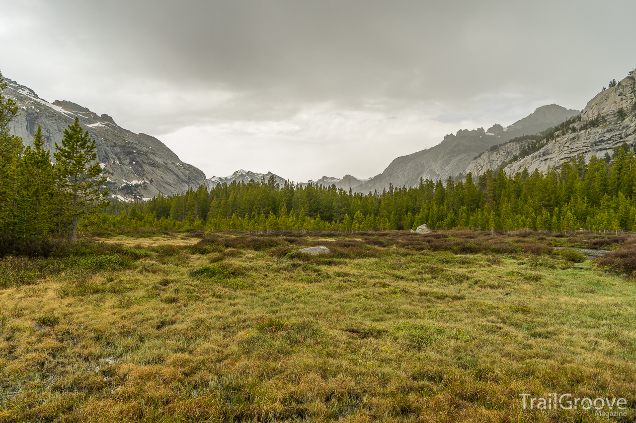
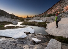
Winter had been especially harsh, even while living in the mild climate of Colorado’s Front Range. Multiple subzero nights had made me tired of the cold, longing for a warm retreat. As good as a tropical vacation with white sandy beaches sounded, I felt the need to get out and get dirty in the desert. I had backpacked into the Grand Canyon a year before in the spring of 2013, but it was an unplanned trip, and I had been very lucky, grabbing a walk-in permit for Bright Angel Campground.
On a topographic map, the contour interval is the physical elevation difference between each contour line, usually expressed in feet or meters. The smaller the contour interval, the more accurately landscape features and any elevation changes will be represented. Understanding contour lines and the interval when performing map and compass navigation are key skills to have, and especially useful for offtrail travel, though be aware that micro features are not always well reflected – a slope that
I have never been inspired to do a multi-day trip from an overlook, but that was before Capitol Reef. In May of 2013, I took my dad to southern Utah for a road trip. I was still recovering from surgery, limiting myself to merely driving. On our way home, we drove the Burr Trail, a scenic backway through the heart of Capitol Reef National Park, and on the map I saw a point called Halls Creek Overlook. We decided to drive out of our way to see it, and I was blown away by the scale that could be se
On every decent map, a map scale should be provided near the legend. Map scale can be used to determine the level of detail a map will possess and is expressed as a fraction formula, such as 1:100,000. What this means is that every 1 unit (inch, foot, etc.) is representative of 100,000 of the same unit on the ground. For example, 1 inch in this case is representative of 100,000 inches in real life. Map scale can get a bit confusing. A small scale map will have a larger fraction and a large scale
Humans have long sought routes through mountains for travel, trade, and warfare. Archaeologists recently unearthed evidence that suggests that in 218 B.C., Hannibal and his army crossed the Alps at a pass now called Col de Traversette. While we're less likely to travel with 30,000 soldiers, 37 elephants, and 15,000 horses and mules these days, we still seek low spots when moving through mountains.
Mountain Pass in the Rockies
Passes and Saddles
In simplest terms, a pass is t
The desert is full of little gems, and again I was off to explore another little nook in the wide expanse of the Colorado Plateau in Utah. As I headed south on U.S. 191, passing through the sleepy towns of Monticello and Blanding, my headlights cut through the darkness of the night-shaded road. I was on another unplanned road trip, fueled by my need for some space and nature therapy after having a typical week in the city.
After car camping for the night I awoke the next morning to my
Canyons are compelling for reasons I rarely consider on a conscious level. Like no other terrain they attract me with an intrigue born of curiosity and an underlying sense of danger. The potential for flash floods, snakebite, falls, and losing my way brings an edge to the experience of walking a path between walls of stone, not knowing what’s around the next bend – this is the essence of a canyon. Slot canyons compound the appeal – their narrow, sinuous heights enclose me as I probe their depths
I sat with my face squished against the passenger-side window, trying to get a better view of the toothy white summits jutting above the western horizon. Driving south on Interstate 5, Mount Shasta hardly seemed worth a glance compared to this jagged range I hadn’t even realized existed. Pulling up Google Maps, it didn’t take long to identify the range. A quick search brought stories of rugged traverses of knife-edge ridges and lakeside campsites ringed by granite cliffs. Looking back at the sno
The first light of morning begins to stream over the mountains, through the tree’s canopy, and into your tent. These mornings were welcome, as seeing the sun’s morning glory while still bundled up warmly inside your tent was actually a rarity on the JMT. More often than not, however, you’re confronted with the unenviable task of rising to the dark, cold blanket that lies heavily on your campsite before the sun’s rays have the chance to lift it off.
Chilly mornings thicken the blood and slow
Imagine standing in a circular tube of smooth stone around 30 feet high with emerald green pools of water at your feet and golden, glowing light shining through the entrance of this natural wonder. This would be the destination of the Subway hike in Zion National Park. Especially during the fall color season of early November, the Subway hike should be on your short list. You’ll need to be prepared for a rugged, backcountry day hike that requires some route finding but the rewards are quite high
When a trip has great scenery, plenty of lakes with nice-sized trout, and hardly any crowds it seems to be worth repeating – even if that means leaving some other destinations on my “places to hike list” for another year. Fall weather had arrived – and with snow already falling in the high country (but fortunately not sticking in most places, at least not yet), I found myself getting rather anxious about which trips to wrap up the backpacking season with. Internal discussions about prioritizing
Mountains rarely conform to the version a child might draw of a simple inverted cone. Instead, they often sprawl in many directions and are rumpled with lumps and divots, like an unmade bed. The very highest of the lumps is the summit, which may be part of the humped or domed mass of mountain, or it may rest at the tip of a sharp point, in which case it's also a peak. A single mountain may have multiple peaks, but only one summit.
From summits to spurs and buttresses, a mountain is ma
When I first started hiking, I knew the names of only a few wild denizens of the forest: ponderosa pine, gray jay, Colorado columbine. Over the years, as I learned to identify more trees, birds, and wildflowers, I also began to see more. As I hiked down a trail, greeting familiar plants like old friends, I realized they grew among a leafy ground cover whose name I did not know. I became more attuned to small movements that drew my attention to an insect, bird, or mammal.
I noticed the
Washington's Cascades have an unfriendly reputation. Unlike the Rockies and Sierra, whose alpine basins and gentle saddles allow for easy travel, the Cascades are a maze of serrated ridges and deep, heavily-forested valleys containing swift-flowing rivers. While miners built high roads in Colorado in the 1800s that now service trailheads, most Cascades trailheads are in valley bottoms barely above sea level, deep in the dense coastal forest. The crux of a climb is often escaping 4,000 feet of ve
5am – July 4th 2013 – “What am I doing?” pops into my head before getting a few hours of sleep. The previous night entailed 8 hours of driving to shuttle my car to the end of Forest Road 43 in the middle of nowhere. After leaving it in darkness on the far eastern slope of the Uinta Mountain Range, we switched cars and drove another five hours to reach our destination. My GPS showed that I was over 55 miles away from where we had left the car, but I knew the trek to get there would be closer to 8
Lumens are a unit of measurement used to determine the total amount of visible light emitted from a source. In the backpacking and hiking world, you can use the lumen value to compare the amount of lighting you’ll get from various nighttime illumination sources such as a headlamp.
Lumen Considerations / How Many Lumens
Higher lumen values typically come at the cost of shorter runtimes and decreased battery life. Brighter lights are also generally heavier and more expensive. For general
Years ago, Governor Tom McCall of Oregon had a strange idea: he wanted to make all the beaches of Oregon open to the public, as he felt that the beaches belong to the people of Oregon. Now 382 miles of state trail exists from California to Washington along the beaches of Oregon, over headlands, through state parks and Federal land, and as rights-of-way over private land – some of the most beautiful country the state has to offer.
Most of the trail is along the beach or along maintaine
With names like Gnome Tarn, Dragontail Peaks, and Aasgard Pass, you’d think I’d stumbled into a land of Norse Sagas. But instead I walked through a land of water and granite surrounded by the fall color of subalpine larch. The Enchantments are a small section of the Alpine Lakes Wilderness in northern Washington’s Cascade Range. This is a land of high valleys and beautiful aqua-marine lakes, all lying under the ever-present view of Prusik Peak.
While an Enchantments hike can offer rew
The Anaconda Pintler Wilderness is an overlooked gem in the state of Montana. It doesn’t have the notoriety of a Glacier National Park, or the iconic awe of “The Bob” (as in the Bob Marshall Wilderness), but it has the solitude and grandeur of some of the best wilderness the west has to offer. Lying in the vicinity of Butte, Montana, but closer to the copper-smelting town of Anaconda, this wilderness is part of the spine of the Rocky Mountains and also encompasses a 45-mile stretch of the Contin
The snow began to fly even before I put on my hiking shoes, but wasn’t this still August? It was, but any mountain range worth its salt was going to have snowfall in August, and this seemed to be the norm for me backpacking in Wyoming. Besides, I’d rather have snow than rain any day, and these colder temps meant only one thing: the death to millions of mosquitoes!
Rugged terrain and a scenic waterfall in the Bighorn Mountains.
A Backpacking Loop in the Cloud Peak Wilderness
The Goat Rocks wilderness is located in the Gifford Pinchot National Forest of Washington, between the Mount Adams wilderness and Mount Rainier National Park. The remnant of an old volcano which stood at over 12,000 feet is now an area of alpine scenery with many peaks over 8,000 feet. The wilderness contains 105,000 acres and I’ve hiked through this area a few times before, but recently I made a trip into the backcountry to camp and walk a bit of a wilderness trail loop.
The protecti
Water and sand, water and sand, water and sand – it’s been a few years since I visited the canyon country of Utah and I forgot about the mix of water and sand here that can permeate one’s hiking shoes. I should have worn sandals. I read about walking the wet canyon bottom, but I stuck with my hiking shoes anyway. This time I arrived to explore Coyote Gulch, a photogenic but crowded canyon which cuts across Grand Staircase National Monument and the Glen Canyon National Recreation Area of south-ce
The words “wintry mix” are horrible enough to hear if you’re just commuting to your job, but they’re even more terrible if they’re in the forecast for a backpacking trip. When a wintry mix is predicted, it often means that a backpacker will have to deal with multiple forms of precipitation – rain, sleet, snow, and perhaps even freezing rain – as the temperatures fluctuate from night to day or due to elevation during a trip. What might start off as a miserable cold rain can shift to sleet before
The people of Idaho know what a gem they have in the Sawtooth Range, but few people elsewhere in the world have a clue it exists. Recently my travels took me to Stanley, Idaho which lays claim to being the gateway to the Sawtooths, and from here it’s an easy drive to numerous trailheads in the Sawtooth Range. I have photographed this mountain range many times around its periphery, but this time I wanted to backpack through the heart of these mountains. With the help of a shuttle, who would shutt
There’s a geologically interesting Chinese Wall that’s not in China. It is part of the million-plus acre Bob Marshall Wilderness of Montana and consists of a 15-mile, 1000-foot cliff of limestone that runs north to south along the Continental Divide. The last time I hiked along the base of the wall was in mid-June during my hike of the Continental Divide from Canada to Mexico. That time I post-holed through 4-12 feet of snow, so I wanted to return in nicer climes and for the opportunity of bette