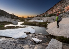
It's always hard to enjoy a backpacking trip when you don't sleep well, and sleeplessly shivering throughout the night is one way to guarantee a rough next day. Here's a list of 10 tips, ideas, and considerations that should help the next time your backcountry trip coincides with those colder nights.
On this frigid morning, my coffee froze in my cup before I could finish it. Luckily with the right gear I slept warm the night before.
A Nalgene Bottle
Trapping your heat utiliz
One thing that I seem to love are maps. When I’m not on the trail backpacking or hiking I’m most likely planning my next adventure, or when I head home from a trip I always seem to find myself staring at sets of maps to find out what the name of that peak that I saw in the distance was, or just where that other trail lead from a fork when I went right and the other trail went left.
Maps at Home
Usually, this results in maps spread out across the house for days – once I find out just wh
While backpacking during an all-day rain presents its own challenges when it comes to staying dry – or as dry as possible – protecting your gear and the items in your pack that must stay dry comes with its own set of considerations. Having a dry jacket, clothes, and a dry sleep system at the end of a long rainy day is not only backpacking luxury, it’s also critical to our safety on the trail. And whether rain is in the forecast or not, in most backpacking locations we still need a strategy to ke
Among smartphone mapping and GPS apps, Gaia GPS is one of the most popular and one of my favorite smartphone applications for backpacking and hiking. The app is continually updated, and over time it's been one tool I've utilized to plan my backcountry trips at home and to plan out days while on the trail.
The app has the ability to store what would equate to a huge stack of USGS topos right to my phone for offline use, and is free to download for iOS here, or find it for Android here.
Every hiking season offers up its own set of challenges, and when it comes to the seasons of spring and summer the presence of flying and biting insects and other related concerns will need to be addressed in many locales. Dealing with insects such as mosquitoes, black flies, and ants along with other concerns like ticks to name a few is a top priority for any warmer weather outdoor excursion. These pests can be anything from just that – a simple pest, or they can even ruin a trip in short order
Whether it’s a trip along a National Scenic Trail or a quick weekend backpacking excursion into an obscure wilderness area – when the mountains are calling, our trips to many backpacking and hiking destinations will also take us into bear country. When hiking and camping in these areas an extra set of considerations will be added to our pre-trip planning process and a few extra gear items will need to be added to our gear list to approach bear country backpacking in the proper manner.
In recent years concern has risen in some circles of the outdoor community regarding the impact that sharing hyper-specific location information can potentially have on specific outdoor places and wilderness. While this has always been a topic of discussion in the outdoor community over the years, the more recent popularity of social media has made it easier to post something like the coordinates to an obscure place, and potentially overwhelm it with visitors in a near instant time frame, at lea
Ten years or so ago, questions about smartphones were just beginning to come up in backpacking circles. Questions like “Do you take your phone with you on the trail?” were typically asked. Some – including myself at times, saw little reason to take the extra weight and a potential distraction into the wilderness. Others simply packed theirs along so they didn’t have to leave it in their car at the trailhead where it could be stolen. However, these days you are more likely to hear questions perta
Spring has sprung and in Colorado that means drying trails and couloirs packed with stable, hard snow. In go the ski boots and from the closet come trail shoes and mountaineering boots. Sadly, my last pair of shoes died a grizzly death at the hands (feet?) of my extra-wide pinky knuckle because I was too lazy to lace them correctly. Below are my tips on funny looking lacing for funny looking feet.
My 2016 Lone Peak 2.5's – ready for the trash bin thanks to a 2" long hole.
F
If your next trip is taking you to a popular trail in a National Park or areas where campsites are available by obtaining a permit and making a backcountry reservation, often times there will be little to decide upon when it comes to choosing a campsite; if designated sites are all that’s available most of the deciding has already been done for you. When exploring more remote wilderness areas and in all areas where dispersed or zone camping is allowed or all that’s available however, when choosi
When I became intrigued by the trout swimming in mountain lakes in the Northern Rockies, I realized the tenkara rod gathering dust in my gear room would be a great way to test the waters before outfitting myself with a full fly rod and reel set up. Tenkara is a Japanese method of fly fishing that focuses on simplicity and forgoes a reel in favor of a longer rod length, fixed amount of line, and uses as few fly patterns as possible. Presentation, mindful casting, and technique are emphasized more
On every decent map, a map scale should be provided near the legend. Map scale can be used to determine the level of detail a map will possess and is expressed as a fraction formula, such as 1:100,000. What this means is that every 1 unit (inch, foot, etc.) is representative of 100,000 of the same unit on the ground. For example, 1 inch in this case is representative of 100,000 inches in real life. Map scale can get a bit confusing. A small scale map will have a larger fraction and a large scale
Every backpacker should have a slightly miserable trek just once in their life. Nothing extreme – just one with a bit of good-old fashioned discomfort. Maybe a rock under a sleeping bag, or a slightly damp boot during a section of a hike – it’s during those moments of less than easy explorations that the true value of the little amenities becomes evident, and much more appreciated. The small bits taken for granted on daily basis are sincerely cherished on the trail. That being said, there is no
Humans have long sought routes through mountains for travel, trade, and warfare. Archaeologists recently unearthed evidence that suggests that in 218 B.C., Hannibal and his army crossed the Alps at a pass now called Col de Traversette. While we're less likely to travel with 30,000 soldiers, 37 elephants, and 15,000 horses and mules these days, we still seek low spots when moving through mountains.
Mountain Pass in the Rockies
Passes and Saddles
In simplest terms, a pass is t
Mountains rarely conform to the version a child might draw of a simple inverted cone. Instead, they often sprawl in many directions and are rumpled with lumps and divots, like an unmade bed. The very highest of the lumps is the summit, which may be part of the humped or domed mass of mountain, or it may rest at the tip of a sharp point, in which case it's also a peak. A single mountain may have multiple peaks, but only one summit.
From summits to spurs and buttresses, a mountain is ma
When I first started hiking, I knew the names of only a few wild denizens of the forest: ponderosa pine, gray jay, Colorado columbine. Over the years, as I learned to identify more trees, birds, and wildflowers, I also began to see more. As I hiked down a trail, greeting familiar plants like old friends, I realized they grew among a leafy ground cover whose name I did not know. I became more attuned to small movements that drew my attention to an insect, bird, or mammal.
I noticed the
The words “wintry mix” are horrible enough to hear if you’re just commuting to your job, but they’re even more terrible if they’re in the forecast for a backpacking trip. When a wintry mix is predicted, it often means that a backpacker will have to deal with multiple forms of precipitation – rain, sleet, snow, and perhaps even freezing rain – as the temperatures fluctuate from night to day or due to elevation during a trip. What might start off as a miserable cold rain can shift to sleet before
Whether you’ve decided to take your first winter trip, or you’re just trying to extend your summer camping in the shoulder months, staying warm during the winter months requires some additional thought when compared to 3-season conditions. Winter and shoulder season adventures are great because areas that are normally very busy in the summer will be empty, and you can experience a new season of adventure. The following is the way I keep warm on my winter adventures in the mountain west, as well
Declination refers to magnetic declination – the difference between true north and magnetic north. This poses a conundrum when navigating and utilizing maps, as maps are oriented to true north, but your compass needle points to magnetic north. This difference between true north and magnetic north will be listed on any decent map and can be looked up online.
Magnetic declination will vary by location, and many compasses allow you to adjust for the exact declination of an area to make n
It is a cold, blustery day in the Colorado backcountry. The mountains are covered in a blanket of snow. The tree branches are bending under the weight of the previous night’s snowfall. A canopy of branches is over the trail. My breath forms a cloud in the morning air. My cheeks are cold. I do not dread heading into the mountains in these conditions. I embrace them. I am about to explore the backcountry. Not plodding through the snow in boots. Or stomping down a path with snowshoes. I plan on gli
When hiking and backpacking in the winter, having the knowledge and preparation to easily build a snow shelter is an essential skill. Some people even prefer snow shelters over tents during the winter because they are quieter and warmer than even the best 4 season tents on the market, which can be very pricey too. Even for people that do not plan on spending any overnights in the backcountry during the winter, knowing how to quickly construct a solid snow shelter is a good skill to have in case
On a topographic map, the contour interval is the physical elevation difference between each contour line, usually expressed in feet or meters. The smaller the contour interval, the more accurately landscape features and any elevation changes will be represented. Understanding contour lines and the interval when performing map and compass navigation are key skills to have, and especially useful for offtrail travel, though be aware that micro features are not always well reflected – a slope that
Snow Water Equivalent is a measurement used to determine the total amount of water mass contained within the snowpack of a specific geographical area, usually expressed in inches of water (if the entire snowpack were to melt, this would in turn = X inches of water). SWE is a particularly useful way to measure potential spring and early summer runoff as well as a good way to predict year to year when trails will start to become free of snow.
Since snow and snowpack contains a substanti
Imagine hiking through a dark and narrow slot canyon. So narrow that you’re moving sideways as your chest and shoulder blades are touching the canyon walls as you go. Just around the corner you can see a glow that looks like molten lava pouring down the wall. That’s what the slot canyons of Southern Utah and Northern Arizona can offer. Slot canyons provide some unique hiking challenges and extraordinary beauty as other worldly landscapes unfold right before your eyes. The wild colors, textures a
For hikers in mountainous and / or northern areas, and especially for hikers that also bring along a fishing rod on their trips, there are two milestones that fairly reliably mark the start and end of the summer and fall seasons. Ice out is when lakes are free of winter ice and ice in is when they freeze over again. Ice in and ice out dates vary regionally, and in mountainous areas there are also significant variations even within the same range.
Elevation and aspect are the biggest c